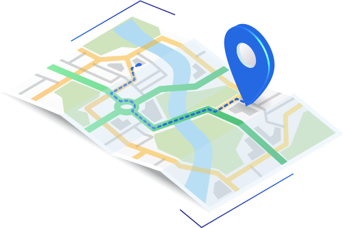
Geocodes Basics: What is Geocoding?
Geocodes are basically a set of latitude and longitude coordinates of a physical location, and for businesses, this geocode usually belongs to an address. Geocodes can help streamline several business operations and enhance their reach. Another new term that is fast gaining popularity in business circles is geocoding. Geocoding is the process of converting a physical address or a location into a set of (latitude and longitude) coordinates so that they can be displayed on a map with utmost precision.
Geocodes and geocoding are two things that businesses in the past hardly used, but it has changed over the years. Today, they play an important role in streamlining many services and can change the way businesses work on a holistic level. Geocoding enables businesses to efficiently access different locations based on the target demographics of their unique business. Additionally, you can even use reverse geocodes to convert geographic coordinates to physical addresses.
This article discusses the finer details of geocodes and the process of geocoding. We start with the basics of geocoding and its accuracy. The article then discusses the different applications of geocodes, especially for businesses. Furthermore, the article explains how you can find a geocode and elaborates on the process of reverse geocoding. The article aims to give you a comprehensive idea of geocodes, geocoding, and their relevance in helping businesses grow.
Geocode Basics
The truth is that most of us are already aware of the geocode basics from school, except that we know them by the term “latitudes and longitudes” in geography. They are a geographic coordinate system used to specify the exact location anywhere on Earth. In other words, geocode is merely a simple term that you use instead of latitude/longitude.
As you may have already inferred, geocoding is the process of converting a descriptive location like a street address into geocodes or lat-long coordinates. Geocoding is being used by more and more businesses for various applications every day, but the most popular application is often in location-based marketing strategies.
Accuracy of Geocoding
The accuracy of geocoding is arbitrary and is entirely dependent on the geocoding process that you use. Different geocoding processes have different geocoding accuracies. Some geocoding processes use values like the ZIP code for generating the geocode of a location, but this is not always the case. The different geocoding processes use different values or methods for determining the geocodes. Below, we discuss the four major geocoding processes and their accuracies.
ZIP+4 Level Geocode
The ZIP+4 code represents a postal delivery route, and these routes typically consist of ten to twenty addresses. The ZIP+4 code is used to represent a postal delivery route, and these routes typically consist of ten to twenty addresses. Here, the approximate centre of the delivery route of a ZIP+4 code is taken. As a result, the ZIP+4 code level geocode can be accurate on a block level, which means that this is ideal only for looking to get an approximate location of addresses.
Interpolated Geocodes
Interpolated geocodes apply a mathematical formula that we are all familiar with from school. But, don’t be alarmed. You don’t need to do the actual math for the geocoding yourself because you can use a simple program to do the math for you. Suppose the addresses you are looking for are all lying between points A and Z (known geocodes), and you need the geocodes for points B and C that lay in between A & Z. Here, the computer program would put the points B and C at regular intervals between A and Z and set a pattern. However, the interpolation geocodes are only accurate to a street-segment level and on a rooftop level.
Parcel Centroid Geocodes
The parcel centroid geocode is obtained by accounting for the known boundaries of a property. In this type of geocoding, after accounting for the boundaries, you’d need to approximate the geocode in the centre of the parcel. The larger the package, the less useful a parcel centroid geocode will be for your business. Parcel centroid geocodes are, however, much more expensive than ZIP+ code geocoding or interpolation geocoding. This means that this type of geocoding is only used in specific cases.
Rooftop Geocodes
Rooftop geocoding is the most accurate geocoding process that you can find. It is capable of showing you the precise location of the primary structure you need the information on. Rooftop geocodes started out as parcel centroid geocodes, but it was later optimized by incorporating additional data points. However, this means that rooftop geocode requires additional data, and getting this data can be much more expensive than you might think.

Geocoding Applications
Geocoding has numerous applications in real life, and the scope of its application only seems to be growing with each passing day. If you were to generalize the application of geocodes, then you could say that geocoding is used to determine the precise location of something or somewhere on the Earth’s surface. However, it is virtually impossible to discuss all the applications of geocoding. Below, we take a look at some of the most popular geocoding applications.
Sending Coupons
Suppose you are a company with a presence in all major cities inside Canada, and you want to run a direct mail marketing campaign employing discount coupons in a metropolitan area. Geocoding can help you target your direct mail by figuring out which of the addresses are nearest to which of your franchise locations. This way, you can print the address of the nearest restaurant’s location on each mailpiece or coupon based on the locality they are sent. Such an application only requires a ZIP+4 level geocoding, which means you can minimize your expenses and maximize your reach.
Insurance Risk Assessment
Risk assessment is an important part for insurance providers and others who work closely with the insurance industry. So, suppose a property to be insured is located on a farm that stretches for hundreds of acres, or two hundred to be precise. Let us also assume that the position of the house is just more than a dozen feet away from the lake. Using high-precision geocoding, like rooftop geocoding, you can easily determine if the home is really 13 ft away from the lake. Getting access to such precise data will enable insurance providers to carry out much more accurate risk assessments, allowing them to make more accurate quotes.
Telecommunications
Telecommunications is yet another field that greatly benefits from the application of geocoding. Telecommunication companies need to provide adequate signal strength and ensure that their customer’s requirement is met. Using geocoding, they can direct their signal to structures where there is high traffic or demand for quality signals. This allows telecommunication companies to channel their signal to places where they are needed instead of aimlessly directing them toward empty parking lots or open grounds.
Reverse Geocoding
If geocoding is the process of finding the geocodes or latitudinal and longitudinal coordinates of a specific location, reverse geocoding is where you use the geocodes or latitudinal and longitudinal coordinates to find the address. The process of reverse geocoding is underutilized for the most part, but it holds great potential for businesses. Although reverse geocoding is employed for identifying addresses from a point given on the map, you fully expect it to expand its applications in the near future.
Geocoding With Google
Did you know that Google actually allows you to geocode locations? The geocoding services from Google and Bing usually manage to geocode places to parcel centroid or even rooftop-level accuracy. However, there is a catch. The geocode you can get through Google or Bing is not always reliable. Sometimes they give you geocode locations that don’t even exist, which is unacceptable for carrying out business operations.
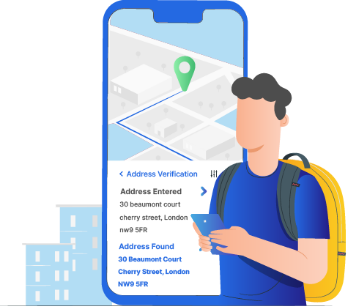
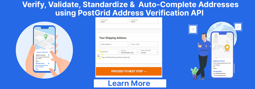
Think about all the times when Google Maps has taken you to the middle of nowhere and said, “You’ve arrived at your destination!” and it should give you an idea about how reliable their data can be. This means that even if you are provided with geocodes for the locations you are looking for, there is a good chance that the data you get is wrong. A simpler and much more effective alternative will be to use an advanced address verification tool like PostGrid to ensure that the addresses are real and deliverable.
Conclusion
Geocodes and geocoding are quickly becoming popular for their ever-growing business applications. We have discussed the basics of geocoding, its accuracy, the major geocode examples, and even reverse geocoding. The most prominent use of geocoding right now is marketing and, more precisely, direct mail marketing. Geocodes can help you streamline your direct mail marketing efforts when you use it with advanced direct mail solutions like PostGrid. Using a solution like PostGrid enables you to verify the validity of the addresses you have and ensure their deliverability.
| You may also want to read | |
|
1. |
How to Grow Insurance Business? |
|
2. |
Cross Sell Campaign Postcard |
|
3. |
What is Self Mailer and its Types |
|
4. |
Retail Marketing Automation |
|
5. |
Hipaa Compliant Print and Mail |
|
6. |
Corporate Gifting Platform |
|
7. |
Print Mail Catalogs |