County-ZIP Code Database: Benefits, Use Cases, and FIPS Codes
Wouldn’t it be helpful if there was a list of all the ZIP codes in a county? With this information, you will know exactly where your target audience resides. This will expand your pool of opportunities.
If you are looking for such granular information, you need a County-ZIP Code Database, which you can avail of using an address verification solution. The real-world county and ZIP code combination list will offer a wealth of information. You can use it to understand geographic, demographic, and service-related details.
This blog discusses the County-ZIP Code Database, what it entails, and its benefits. You will also discover how different industries can use it, ways to find it, and how FFIP codes can ensure uniformity.
Key Takeaways
- Unlike standard databases, the US county ZIP code list has real-world county and ZIP code conjunction. This helps in precise data collection since a single ZIP code can encompass areas in multiple counties.
- It includes county names, geographical coordinates, area types, tax jurisdiction information, and more, providing detailed insights.
- Businesses across industries can use this list. Whether retail, insurance, or healthcare, the data facilitates a better understanding of the target audience.
- There are multiple ways to find county ZIP code data, such as ZIP code look-up, rooftop geocoding, address mail API, and address verification software. PostGrid offers these services to companies in all sectors at affordable prices.
- FIPS codes can act as an efficient tool for the standardization of county code in a County-ZIP Code Database. It facilitates better data accuracy and enhances analysis.
What is a County-ZIP Code Database?
It lists all the ZIP codes and counties that exist within the U.S. and are deliverable by United States Postal Service™ (USPS) mail. Databases, in general, only list one county for each ZIP code. But the US county and ZIP code list has every county ZIP code combination that exists in the real world.
The ZIP code boundaries are set by USPS to help in efficient mail delivery. They have nothing to do with the city boundaries. One ZIP code might run across several counties and might even cross state boundaries. Several counties can have one particular ZIP code. The US County ZIP code list mentions every ZIP code that lies partially or completely within a county.
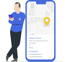
The ZIP code county list will also tell you the details of a county that contains a certain portion of the ZIP code. You can also refer to it to find out the preferred city name and Federal Information Processing Standards (FIPS) code associated with each ZIP code. If you have a list of ZIP codes and need the county names, you can use an address verification service for data enhancement and validation. One such service is PostGrid, which can convert your outdated, incomplete mailing lists into deliverable, updated ones.
What Kind of Data Will You Find in a List of Counties by ZIP Code?
The ZIP code and county database creates a structured link between ZIP code and counties by providing the following information.
ZIP Codes Information
- Primary ZIP code: It is the standard five-digit ZIP code assigned to an area.
- ZIP+4 codes: A ZIP code extension with nine digits that provides accurate information down to the apartment and the building number.
- Associated postal cities: It lists the ZIP code and their associated towns and cities, including their preferred and alternate name.
- Type of ZIP code: Based on the area, the ZIP code can be standard, P.O. Box only, or unique.
- Time zone: It mentions the local time and daylight savings time.
County Information
- Name: It mentions the name of the county associated with each ZIP code.
- FIPS code: A five-digit code that identifies each county. It ensures data is consistent, accurate, and up-to-date.
- Seat: The administrative centre of the city.
State Information
- Name: The state’s name where the county and ZIP code are located.
- Postal code: It is a two-letter postal abbreviation for the state, for example, CA for California.
- State FIPS code: It is a part of the full county FIPS code, which includes two digits for the state.
Geographical Information
- Coordinates: The latitude and longitude represent the precise centre of the ZIP code.
- Area type: It denotes whether the area is urban, suburban, or rural.
Coverage and Service Information
- Postal service boundaries: It defines whether the ZIP code crosses county boundaries or is contained within one county. It also shows the percentage covered in the area code.
- Service availability: It indicates whether or not mail service or emergency response is available in the ZIP code and county.
- Delivery points: It displays information about the residential, business, and P.O. Box delivery points within a ZIP code.
Using PostGrid, you can create an entire list of delivery addresses county-wise or ZIP code-wise. Thus, you can have accurate, standardized records of your current or potential customers residing in a particular area. You don’t just get the county-ZIP code database—you can also get your hands on the census data, carrier route, and Delivery Point Validation (DPV) codes.
Benefits of Knowing List of Counties by ZIP Code
Understand Target Audience
Understanding demographic data is crucial for a business to tailor their products and services to the needs and preferences of the target audience. Businesses gain insights on a deeper level with a list of counties by ZIP code.
They can connect ZIP codes with county-level-specific information such as income, age group, and population density. It will help in creating a customer profile and facilitate a better understanding of the needs and behaviour of the target audience in a particular geographic area. If you need custom mailing lists or want to create one to target specific audiences, you can always use PostGrid!
Optimize Marketing Strategies
ZIP code list by county provides granular and location-specific insights. Using this, businesses can execute effective marketing, service delivery, and customer outreach strategies. The focus on ZIP codes and counties will equip businesses to recognize the target audience and create ads, and promotions that reach the right audience in the relevant location.
Understanding that priorities, needs, and lifestyles change with every county, businesses will be able to allocate resources efficiently. Instead of spreading the budget too thin, they can focus their efforts on counties that have maximum potential. This will maximize impact and boost the possibility of a profit.
Keeping a tab on how counties and ZIP codes are responding to marketing campaigns can help businesses adjust their strategies. The ZIP code listing by county offers flexibility which helps businesses reach the right person in the right place and at the right time.
Identify New Opportunities
Businesses can use the county listing by ZIP code to search areas with high potential. Using this information they can plan to open a new retail office, location, or warehouse. The record will also help businesses identify underserved areas.
Take, for instance, a country that shows high growth potential but has no limited competition. The business can use this opportunity to enter the market and build a community of customers. Moreover, periodic analysis of trends in counties and ZIP codes can help businesses with product development, and adapting services to marketing needs.
The ZIP county database can also help devise cross-selling and upselling strategies. Take, for instance, businesses notice that a certain product is doing well in a specific zone. They can replicate the marketing strategies in areas with similar demographics to expand the customer base for the product.
However, always run an address verification check before indulging in marketing activities. You can cross-check your mailing addresses via PostGrid’s address verification API or software, ensuring they are deliverable and valid.
Industry-Wise Use Case of List of Counties by ZIP Code
Marketing
The team can use the county list by ZIP code database to segment their audience and create tailored campaigns for specific regions. This hyper-localized marketing will boost the engagement rate. The categorization will prove beneficial to businesses that are active in multiple regions and have a varied customer profile.
Insurance
Knowing US postal ZIP codes by county can help insurance companies assess the risk level for policyholders. Take, for example, the National Weather Service shows a certain county is prone to natural disasters like hurricanes, or floods. This will impact the premium rate. Keeping a note of regional risk will help insurance companies determine the appropriate insurance rate.
Moreover, knowing a homeowner’s details down to the ZIP code and county will assist insurers in staying compliant with specific laws and regulations governing insurance rates in the county.
Fraud detection is a matter of concern for insurance companies. Linking the County-ZIP Code Database with a fraud detection application will help identify any abnormal claim pattern, suggesting fraud. You can add address verification to your workflow to detect fake or invalid mailing addresses, bringing you closer to identifying fraudulent transactions.
Healthcare
Health Maintenance Organizations (HMOs) can list ZIP code county data to define the coverage area of the healthcare service providers, By knowing where the enrollees live, they can ensure that whenever needed, the healthcare provider is accessible and within the coverage area.
The ZIP code and county data prove instrumental in understanding population density. The H.M.Os can ensure there are enough healthcare providers where the customers reside.
Retail
By analyzing demographics tied to the ZIP code and counties, retail store owners can ensure that their store offerings align with the customer’s preferences. It will also help in inventory management. By linking the demands for products with the area, they can prevent overstocking or stockouts.
Retailers can offer personalized suggestions based on the demographics. For example, they can offer luxury brands to affluent countries. The County-ZIP Code Database can be also used to offer region-specific promotions. It will make the campaign relevant and more appealing to the customers.
You can always have a list of recently updated and segmented addresses to focus your retail marketing efforts on when you use a reliable address validation tool, like PostGrid.
Real Estate
Property tax rates vary significantly across counties. With ZIP code and corresponding county data, property owners can calculate accurate property tax. It will also assist in considering the local income taxes precisely.
Moreover, by identifying the applicable tax authority, businesses can avoid tax filing errors. They can prevent penalties and audits by ensuring that they charge and remit the right tax to the appropriate jurisdiction.
Also Read: Why Is My Address Not Valid
Ways to Find a List of Counties by ZIP Code
Before finding a County-ZIP Code Database, it is important to find a ZIP code. You can use a ZIP code look-up like the one provided by the USPS. Enter your address and it will return your request with ZIP code details. Once you have a ZIP code, you can find the specific county code in the following ways.
ZIP Code Look-Up
You can again use the USPS ZIP codes look-up tool to find the County-ZIP Code Database. Visit the USPS website, and enter the ZIP code. You will get county details for each ZIP code. However, it isn’t as simple as it appears. There are US Zip codes that cover multiple counties. Take for instance, 38583 is the ZIP code of Sparta in Tennessee. It has five counties- White County, Putnam County, Warren County, Cumberland County, and DeKalb County.
Conversely, not every ZIP code will have a county. ZIP codes are postal codes that can be assigned to a business, organization, or a P.O. Box. County, on the other hand, is a geographic area. Take for instance, the Empire State Building has a unique ZIP code but it does not have a county. Hence, if you simply rely on ZIP code look-up to find the details of the county, chances are you might end up with multiple results.
Rooftop Geocoding
Geocoding is a competent way of finding precise information about the location. It provides exact data such as ZIP and county code. Geocoding can be of different types. To find specific details like the County-ZIP Code Database, leveraging rooftop geocoding is better. It provides you with the correct details down to the apartment number and building name. It will help you differentiate between addresses of different counties and ensure your message reaches the intended recipient.
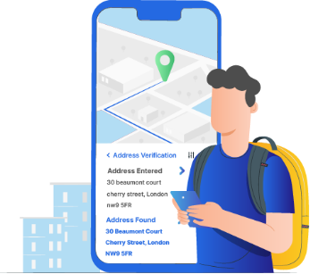
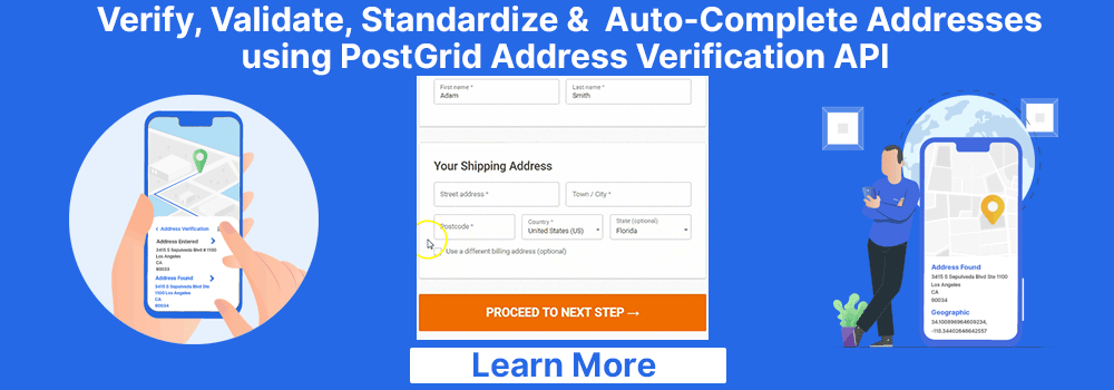
Address Verification API or Software
It verifies, validates, standardizes, and autocompletes data in an address. It checks the accuracy and completeness of an address by verifying it against national postal services such as USPS Some address verification service providers help find county codes by ZIP code. You have to input your mailing address in the tool and it will return county ZIP code data under metadata.
How do FIPS Codes Come Into the Picture?
The FIPS county codes are three-digit numerical codes assigned to a county within a state. These denote the standardized codes developed by the National Institute of Standards and Technology within the United States. They are used to identify counties and counties-like entities within the nation.
Being primarily numerical, they allow for a concise representation of the county. Take, for instance, Garfield County in Utah is designated 49017 as the FPIS code. Here, 49 represent Utah and 017 signifies Garfield County. They can be quickly integrated into the database and information system.
FIPS code standardizes the way of referring a county. This prevents confusion caused by similar county names in different states. For example, Washington County exists in multiple states. FIPS code can help differentiate between them. The FIPS code for Washington County in Oregon is 41067, while 42125 is the code for Washington County in Pennsylvania. Having this information in a county by ZIP code list will ensure proper data handling.
When integrated with the County-ZIP Code Database, FIPS codes can help in mapping, mail routing, and logistical planning. It will ensure that the postal delivery and emergency services are accurately directed to the right counties. Due to its ability to enhance data accuracy, FIPS codes are used by government organizations, healthcare institutes, and postal services.
Run your mailing lists through PostGrid’s address verification services to get adequate county data, enabling you to create a list of accurate FIPS codes.
Conclusion
The County-ZIP Code Database is an invaluable tool for businesses across industries. It can help in aligning marketing strategies, assessing insurance risk, and sending immediate medical help.
You can use address verification tools and rooftop geocoding among other solutions to find these codes. PostGrid offers a holistic address verification service coupled with geocoding capabilities. By seamlessly integrating with your system, it will help you find precise addresses and ensure delivery accuracy. You can use it to find address details down to the apartment number and building name. Find county ZIP code information and verify any mailing address in minutes. Talk to our sales team today.
Frequently Asked Questions
Do U.S. ZIP Codes Cross County Lines?
Yes, there are more than 20% of U.S ZIP codes that cross county lines. Take, for instance, 97635 includes part of Lake County, Oregon, and Modoc County, California. It can also cross state lines, for example, 51023 and 51001 are in both Iowa and Nebraska.
How do I Find the County for Each of the ZIP Codes I Have?
You can use any of the approaches mentioned below to find a county from a ZIP code.
- ZIP code lookup: There are many dedicated ZIP code lookup websites, like USPS, which you can use. Add the ZIP code and it will return the corresponding address information including the county.
- General Information System(GIS): They integrate multiple levels of geospatial data including the county boundaries. You can leverage the coordinates to find out which county a specific location falls in.
- Mapping: Use a tool that comes with mapping capabilities. It will allow you to see the boundary limit of each county and find the code.
How Accurate is the County ZIP Code Database?
The accuracy of a County-ZIP code database depends on how frequently it is updated and the data source used.